Over the last 200 years the watershed has changed from a natural state, to agricultural use, to the current mix of residential, commercial and institutional uses. Much of the original creek channel has either been straightened or enclosed in underground pipes. Today only 2.9 km of the 7.9 cm creek are still above ground.
The Bowker Creek watershed, totaling 1,028 hectares (2,540 acres), is located in the municipalities of Oak Bay, Victoria, and Saanich on southern Vancouver Island. The watershed is composed of a gently sloping basin, with headwaters in the University of Victoria, McKenzie and Shelbourne, and Cedar Hill Park and Golf Course areas.
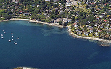
 The main channel of Bowker Creek flows southeast from these headwater areas through the Shelbourne valley, past the Fort Street and Foul Bay Road area, and enters the sea at Oak Bay, near Glenlyon-Norfolk School. Historically, Bowker Creek was a meandering, low gradient stream with numerous small tributaries and wetland areas. Fish and wildlife, including anadromous species such as coho and chum salmon, inhabited Bowker Creek and its tributaries. Local First Nations derived food and fresh water from the stream, and nutrients transported from the watershed helped support a rich marine ecosystem in Oak Bay. Mary Tod Island, situated near the mouth of Bowker Creek was traditionally known by the Lekwungen People as “Kohweechella” which means “where there are many fish”.
 Since the middle of the 1800s, the watershed has become increasingly developed, first for agriculture, and later for residential, commercial, industrial and other urban uses. Agricultural settlement began in 1851, when John Tod established a 200 acre farm in Oak Bay. Shortly thereafter, John and Jessie Irvine began the Rosebank farm, on 100 acres of land near the present day intersection of Cedar Hill Road and Cedar Hill Cross Road. In 1861, the creek was locally known at ‘The Thames,” being the largest stream in the vicinity. The creek was also known as Tod’s Stream, but was formally named sometime later, after John Sylvester Bowker (son-in-law of John Tod), whose farm bordered the creek. Today, the Bowker Creek watershed is largely urbanized, with residential, commercial and institutional land uses predominating. As urban development has spread throughout the watershed, the mainstem and tributaries of Bowker Creek have been altered, with 70 percent of the channel now confined in culverts. These culverts now form the backbone of municipal stormwater drainage systems.