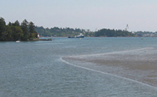
 Esquimalt Harbour is located to the west of downtown Victoria. The Department of National Defence is the largest landowner in Esquimalt Harbour and is home to the Canadian Forces Base Esquimalt and the federally owned Esquimalt Graving Dock which is operated by Public Services and Procurement Canada. Approximately 4,000 military personnel and 2,000 civilians are employed at the Esquimalt naval base, a major economic force and the third largest employer within the capital region.
Esquimalt Harbour is also an important area for local First Nations, residents, recreational boaters and beachgoers. Today, the harbour is used for residential housing, national and municipal park lands and some commercial enterprises. The undeveloped lands surrounding Esquimalt Harbour, particularly those owned by the Department of National Defense, have some of the few remaining natural shorelines and upland natural areas in the region.
Over the past 160 years, many types of industries have operated in the harbour. The shorelines have been significantly altered, and pollution of bottom sediments in the harbour is a concern. Nevertheless, some important natural features remain, such as intertidal mud flats and tidal channels. The area is important to local First Nations, residents, recreational boaters, beachgoers and the Canadian Forces.
About Esquimalt Harbour
- Size (total area): 342.7 ha
- Total length of shoreline: 19,997m (excluding islands)
- Depth of harbour (maximum): 16m (at harbour entrance)
- Creeks that flow into the harbour: Millstream Creek
- Number of stormwater discharges: 97
- Protected areas: Duntz Head Rockfish Conservation Area
- Species at risk: Northern abalone, southern resident killer whales, great blue heron
- History
Valued Habitat
Eelgrass
Esquimalt Harbour has very little eelgrass, with only about 0.5 ha spread out over several small locations. Eelgrass was likely much more extensive prior to the industrial activity in the harbour, but dredging, log booming and infilling of the foreshore has undoubtedly had a major impact on eelgrass distribution and survival. As eelgrass provides critical habitat for juvenile fish such as salmon and herring, as well as a multitude of other forms of marine life, it is vital to protect and enhance the few remaining pockets that persist here.
Estuary and mudflats
Millstream watershed drains into Esquimalt Harbour. This watershed is located along the eastern flanks of the Gowlland Tod range in the Highlands, and also includes urbanized areas in Langford and Colwood.
The Millstream Creek estuary and mudflat is an important feeding area for birds, providing a valuable source of worms, shellfish and other mudflat-dwelling organisms. The extensive mudflats here are home to a variety of intertidal clams that once were an important food source for First Nations people of the area. The harbour is currently closed for clam harvesting due to sanitary contamination and concerns about the potential impact of contaminated marine sediments on human health.
High Current Areas
Esquimalt Harbour does not have many areas of high currents, adding high ecological value to the few that do occur there. Paddy Passage and the channel between Smart and McCarthy Islands are two such high current areas, where sponges, tube worms and bryozoans are common.
Kelp Beds
The more wave-exposed rocky outcrops near the harbour mouth support dense kelp beds dominated by sugar kelp and five-rib kelp. Dense but less diverse kelp beds occur around Smart and McCarthy Islands and along the shoreline between Yew Point and Rodd Point.
Canopy forming kelp beds are rare, but a small bed of bull kelp is located on Whale Rock, the largest subtidal rock outcrop in the harbour.